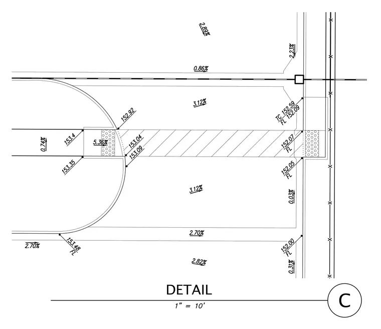
This civil drawing provides site grading and paving details with spot elevations and slope percentages indicated across the paved surface and curb lines. Top of curb and flow line elevations are called out at key junctions. Slopes are designated with percentage values along drainage paths and pavement transitions.
Members view this detail in full resolution, download the CAD files (SVG, PDF), and can adapt it in the built-in CAD editor — export DXF, DWG, or PDF.
Start membership